Votes & Views #36
In my hands is this bible printed
in 1702. No, let me correct that –
the bible is much too big and heavy to hold – it is lying on a table in front
of me. A huge, stately book of
almost ten kilos, bound in wooden boards which have been covered with lovingly
anointed, but heavily cracked leather; the corners are protected by ornate brass
work, and two clasps keep it shut. I
open the book carefully; some newer pages have been inserted, covered with a
beautifully calligraphed genealogy, beginning in 1232 AD, of one of the old Cape families, the de Villiers clan.
I skim over some 4 pages of entries and come to the last name. He has asked me to find a new home for this
treasure, along with another couple of dozen stately, centuries-old books, and
many more recent books dealing with our subcontinent.

Most parents harbour a
hope that their children will one day have the same wish to preserve the
material things that they themselves cherished, used and collected to paper the
walls of their existence. That goes
for the family farm, the ancestral home, the antique furniture or jewellery –
and so often, books. However, since
times immemorial children have had their own headstrong ways. They stubbornly refuse to follow in their progenitors’
footsteps in matters of careers; spending habits; political views, consumption
of stimulants - and reading matter, among others.
A personal library is like a tree;
there is the seed – core books acquired on a specific subject or genre,
or
acquired as a ‘mystery’ lot at an auction; interest is stimulated and
broadens,
so more books are added. Tastes
branch out, mature and find other directions and so a collection grows.
After the proverbial three score years and ten or
thereabouts, comes the cut-off point in every collector’s life. Either
they decide to reduce their establishment
as it has become too cumbersome; they move into smaller, sheltered
accommodation, or their life reaches its conclusion.
In both cases material effects need to be redistributed and disposed of.
The natural inheritors are children and
grandchildren. No problem then. Or is there? The march of technology has
been
relentless; by now it has become a sprint with ever new entries into the
field. The rising generations have less dependence on the
printed word, there are more immediate, electronic, audiovisual forms of
media
on hand. Libraries take up large
amounts of space; they need care; they are subject to fire, damp and
insect
attack. That cherished
assemblage has suddenly become a
millstone round somebody’s neck.
Back in 1947, there
lived a family by the name of Solly near Sir Lowry’s Pass.
There are no Solly’s left in the Cape
that I can find, as the last of that name seem to have departed to live in
France, as the user of their telephone number informs me.
I picture a modestly well-off, aging
family, cultured people with varied interests, living in a large family home on
a farm overlooking False Bay. Their time came, there were no immediate heirs to
inherit. The executors of the estate
moved in and the house, furniture and effects were auctioned off and dispersed
- this much I know. Their small
library, containing some of the most prized works describing life and travels
during the 17th to 19th century in Southern
Africa, was bought by the de Villiers family, and became the
beginning of a new collection.

Now, some seventy years later,
that metamorphosed library has once more come to the end of its existence. The current owners, a few generations later, are
reducing their establishment, and are moving to a retirement village, where
there is no space for libraries. The
following generations have other interests and don’t want to ‘curate’ the books. New owners must be found, which is where I come
into the picture. After our initial contact and perusal of a
list of titles, almost two hundred volumes were dropped off at Africana Books. Since many of these were items I had not handled
before, I drove up to Cape Town ( as I live in the Tzitzikamma forest nowadays
) post-haste, and spent the next week working ten hours a day to acquaint
myself with just twenty of the most uncommon works.
Since these were written in mainly in Dutch and French – languages with which I
have some familiarity, but in which I am not entirely comfortable, this was a
slow process. Still, my findings
were a little like a Who’s Who of early travel round the Cape. So let me tell you about them in some sort of
chronological order.
The oldest item is a little
extract from Churchill’s Voyages, printed in 1707.
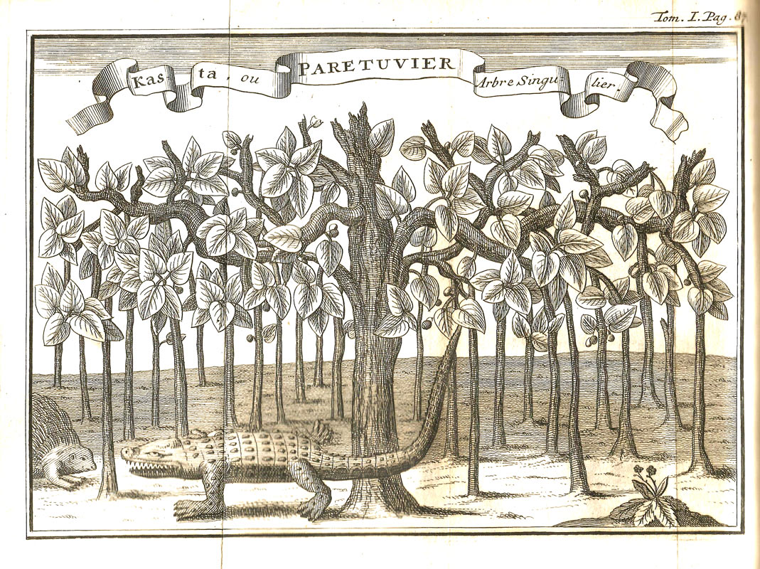
Written by Willem ten Rhyne in 1673, An Account of the Cape of Good Hope. The diary opens on 9 October 1673,
when Ten Rhyne’s ship anchored in Saldanha
Bay.
He writes an introduction on the situation at the Cape,
and then a running commentary by way of 27 short chapters on wild animals,
birds, fishes and insects, plants, seasons, indigenous inhabitants and their
anatomy, garments, dwellings, possessions, character, manners, way of living,
fighting, dancing and religion. Only some twenty pages, yet crammed full of
the remarkable insights on a strange
continent and its people.
A truly uncommon work is Francois Valentyn’s Beschryving van
de Kaap der Goede Hoope, met de zaken
daartoe behorende (Vol 10) published in 1724.
Although the writer had no first-hand travel experience at the Cape, he had
access to the VOC archives, and from there comes a fine early map of the Cape,
the first printed account of Governor van der Stel’s 1685 epic journey to Namaqualand, as well as the lesser known Starrenburg’s
trek into the Sandveld in 1705. The
latter part of the book deals with Mauritius, and there is also a fine
map of that island.

The next two items were in French, by two
clerics, the Abbe de Choisy, and Pere Tachard.
Both of these clerics were en route to Siam,
where their embassies were welcomed in the hope that this would keep the Dutch
at bay in that part of South East Asia. Choisy's account: Journal du Voyage de Siam, from 1686 (this is the oldest travel
book in the collection) is in the form of a diary, and is written in an
attractive style, telling about their visit to the Cape, details of the voyage
and experiences in Siam. The book is a classic that has repeatedly been
reprinted due to the importance of this particular embassy.
Tachard, who was a respected mathematician as
well as a cleric, led the second such expedition in 1687.
The voyage is described in Second Voyage
du Pere Tachard et des Jesuites envoyez par le Roy
au Royaume de Siam. Part of the book touches on the Cape of Good
Hope, where the governor, Simon van der Stel and the visiting commissioner of
the VOIC, H A van Rheede tot Drakenstein, entertained the French party and gave
them a tour of the settlement, as well as helping them with their scientific
and astronomical observations. For
this the governor was reprimanded later, as France was technically at war with
the Dutch.
Then a classic tale of travel, survival and
adversity: Voyage et Avantures de
Francois Leguat & de ses Compagnons en deux Isles desertes des Indes
Orientales. Francois Leguat was a French Huguenot who had fled France to Holland
after the revocation of the Edict of Nantes in 1685.
One Marquis du Quesne had first considered Reunion as a possible colony for
Huguenots, but after the French took that over, he fitted out a small
frigate, L'Hirondelle to reconnoitre the Mascarene islands, and to take
possession of whatever island was found unoccupied, for that purpose. In 1690 Leguat and nine male volunteers
boarded L'Hirondelle for Reunion which they
believed had been abandoned by the French.
Instead he and seven companions were marooned on the uninhabited island of Rodrigues.
After a year, they built a boat and sailed to Dutch-controlled Mauritius, where they were imprisoned due to France and Holland
being at war. After lengthy
imprisonment, the survivors were shipped to Jakarta to stand trial, supposedly for
espionage on behalf of the French.
They were found innocent, and Leguat and two other survivors were returned to England, where
he penned his memoirs. The book is
illustrated with a number of splendidly naïve engraved plates.
Peter Kolbe, another
astronomer at the Cape, spent some 8 years there from 1705-1713, which gave him
the material to compose his work The
Present State of the Cape of Good Hope.
There is a huge amount of natural
history information – most of it admittedly exaggerated and gleaned from other
sources, but his observations of the Khoi around the settlement, their
lifestyle, customs and language are fascinating.
The work is still much quoted as an early ethnographical source.
 The Abbe de la Caille’s Journal Historique du Voyage fait au Cap de Bonne Esperance is next.
He was a distinguished scientist, astronomer and mathematician who in 1750 led
an expedition to the Cape. It was said of him that, during a comparatively
short life, he had made more observations and calculations than all the
astronomers of his time put together and that the quality of his work was
unrivalled. Among his results were
determinations of the lunar and of the solar parallax and the first measurement
of a South African arc of the meridian, which suggested that the earth was more
flattened at the southern pole. He
gives a lively description of the
countryside and inhabitants at the Cape during
his stay. His observations on the
voyage demonstrated the difficulties of navigation to him and led him to devise
a better method of using the moon to determine time and latitude at sea.
The Abbe de la Caille’s Journal Historique du Voyage fait au Cap de Bonne Esperance is next.
He was a distinguished scientist, astronomer and mathematician who in 1750 led
an expedition to the Cape. It was said of him that, during a comparatively
short life, he had made more observations and calculations than all the
astronomers of his time put together and that the quality of his work was
unrivalled. Among his results were
determinations of the lunar and of the solar parallax and the first measurement
of a South African arc of the meridian, which suggested that the earth was more
flattened at the southern pole. He
gives a lively description of the
countryside and inhabitants at the Cape during
his stay. His observations on the
voyage demonstrated the difficulties of navigation to him and led him to devise
a better method of using the moon to determine time and latitude at sea.
Anders Sparrman is a well-known name among early
travellers in the subcontinent, ranking with naturalists like Burchell,
Thunberg and Lichtenstein. This brilliant scientist sailed for the Cape in 1772 to take up a post
as a tutor. When James Cook arrived there later in the year at the start
of his second voyage, Sparrman was taken on as assistant naturalist,
and accompanied the intrepid explorer on his journey, reaching New
Zealand. On his return he spent several years in the Cape and
undertook various journeys into the interior.
His work, with the descriptive title: A voyage to the Cape
of Good Hope, towards the Antarctic polar circle, and round the
world: But chiefly into the country of the Hottentots and Caffres was the result, and was published in 1785. Sparrman, an excellent observer, not only
collected a wealth of specimens, but he had an eye for the country and a
descriptive turn of phrase about the people he met.

His
countryman Carl Peter Thunberg came to the Cape
as a medical doctor. After
his arrival at the Cape, he focused on learning Dutch during his three
year
stay, which was to stand him in good stead in Japan on the latter part
of his travels. In September 1772, in the company of Auge, the
superintendent of the Company garden, they journeyed to Saldanha Bay,
east as far as the Gamtoos River and returned by way of the Little
Karoo. He also met Francis Masson, who was collecting
plants for the Royal Gardens at Kew, and who shared his interests, as
well as
being accompanied by the explorer Robert Jacob Gordon during one of his three
expeditions into the interior, Thunberg collected a significant number of
specimens of both flora and fauna, and has been dubbed the ‘father of
South
African botany’ for his contributions. Four slim volumes, entitled: Travels in
Europe, Africa and Asia, made between the
Years 1770 and 1779, this third edition published in 1795-6, were the
result of his work.
South African travel writing would be a duller,
more monochrome affair if it was not for the works of the inimitable Frenchman,
Francois le Vaillant. It is fitting,
therefore, that there are no less than three examples of his work in this
collection: his so-called ‘first voyage’ in both the first French and English
editions of 1790 ( Travels from the Cape
of Good Hope into the interior Parts of Africa ), during which he had the
misfortune to lose all his equipment at Saldanha Bay when his ship was sunk by
the British, after which he recouped his fortunes and meandered along the
southern edge of the subcontinent returning to the Cape by an inland route. Also present is his second, more historic journey,
published in 1796, in which he penetrated into the inhospitable regions of
Namaqualand and Bushmanland, and even crossed the Gariep
River to penetrate into Namibia,
as has been disputed for years, but now taken as proven.
All described with the irrepressible enthusiasm of a young man out in the
wilds, full of joie de vivre, seeing dangers lurking behind every hill and
romance looming over the horizon.

One of the latter works of travels in the 18th
century was John Splinter Stavorinus’ work:
Reize van Zeeland over de Kaap de Goede Hoop en Batavia
naar Samarang, Macassar, Amboina, Suratte, this published in 1798. He was an
admiral of a small fleet which made an extended voyage covering the Dutch
colonies in South Africa and
the Far East.
He visited Stellenbosch, Hottentots Holland, Vergeleegen, Klapmuts, among other
places in the Cape, and remarks on the position of the farmers, whom he regards
as superior to the Dutch living in the towns, whom he describes as discourteous
and disagreeable, which might in part be due to the arbitrary and rapacious
government they had to labour under - similar to conditions at present, in fact. His general picture of the colony is not a
complimentary one and he paints conditions in the Cape Town hospital as being a complete health
hazard, more likely to spread disease than to cure.
A significant contribution to social history at the Cape
during the latter years of the Dutch rule.
Robert Percival was the officer entrusted by
General Craig to crush resistance at Muizenberg during the conquest of the Cape. He was
the first to enter Cape Town
and there he remained till 1797. On
his return he published a narrative of his journey and a description of the
country, under the title: An Account of
the Cape of Good Hope, containing an Historical View of its original Settlement
by the Dutch, and a Sketch of its Geography, Productions, the Manners and
Customs of its Inhabitants, which
was translated into French in 1806. This
French edition is part of the collection, and though rather thin, is not
uninteresting, and was warmly praised at the time.
His slating of the Dutch settlers and especially of their cruelty to the Khoi,
their sloth, inhospitality, and lack of social graces, are severe. However, he praises the Cape climate as best in
the world and advises the British government, who had just restored the province
by the treaty of Amiens,
to reoccupy it.

After the takeover by Britain, it is
only natural that British travellers and views should become more common. One of the earlier, and certainly more important
accounts, was John Barrow’s Travels into the Interior of South Africa,
of which the second edition, complete with
fine hand-coloured plates by that great artist Samuel Daniell, also
appeared in
1806. Barrow was the secretary of
Governor Macartney, and he was despatched on a round-tour of the country
to
inform the settlers of the administrative changes, and to gauge their
opinions. His work, though marred by bias and antagonism to
the locals, is thought to be an honest appraisal of conditions
prevailing in
the colony, and as such is a treasured part of the literature of the
period.
The era
of missionaries had started. They
came in shiploads, and from the early eighteen-hundreds, missionary accounts
proliferated, from the arid interior, then up the West Coast, and along the
southern edge of the continent. One
of the enduring contributions to this genre was Ignatius Latrobe’s Journal
of a Visit to South Africa. A gentle soul this Moravian missionary, a
talented artist, writer and musician, he embarked on a tour of mission stations
along the south coast as far as the Great Fish River, and planned on
establishing a new mission at Enon.
His book is illustrated with some fine colour plates and his sympathetic
attitude to the folk he met, the understated descriptions of his travails have
won it a lasting place on even modern bookshelves.
The last
of these early works that deserve special mention is Captain W F W Owen, who’s Narrative
of Voyages to Explore the Shores of Africa, Arabia and Madagascar was published in 1833 after a
four year expedition which was undertaken to survey the entire coast of
Africa and southern Arabia. His meticulous work laid the foundation for what
we know about the geography of some tens of thousands of kilometres of
coastline to this day, as he returned with more than three hundred charts. In addition his little flotilla became involved in
subduing pirates in the Mascarenes, and attempting to quash slavery in Mombasa. He had much interaction with the inhabitants of
the ports and islands along the coast, which makes the volumes an interesting
read.
These then are the jewels in the crown of the
collection that Peter de Villiers has entrusted to me to dispose of. There are many more recent works on exploration,
wars, history and biography. All the
above will be offered for sale by auction, on our website and by means of our catalogues which
we send out to our clients at intervals.
We trust that these cultural relics will find new owners, who will appreciate
the contents and the workmanship of these precious volumes.
The auction starts on Thursday, 27th
of August 6.30pm – and bidding ends on 3rd September at the same time, and most of the lots above, as well as other offerings can be viewed and bid on at:
